
 |
North Carolina ceded western territory to the United States in 1789 that became the state of Tennessee, but there was little concern for state lines as there was no one occupying the land other than Native Americans.
But as the nation grew and Tennessee rose in prominence, in 1821 commissioners were appointed by each state to work together and establish the state line, starting at the terminus of North Carolina-Virginia survey. The plan was to follow the uppermost ridgeline of the three major mountain ranges between Tennessee and North Carolina from Virginia to the 35th parallel that was the established southern border, extending across Alabama and Mississippi.
Surveyors ran into problems when some of those ridgelines split with no clear “uppermost.” When the surveying party approached the Little Tennessee River, their survey veered from the ridgeline to the watershed lines of Slickrock Creek and the Tellico River.
Still a line was determined, and copies of their reports were sent to the respective states. North Carolina’s copy was destroyed with the burning of the capitol building in 1832, and Tennessee’s was lost. With no clear definition on record, both states began issuing grants for the same property.
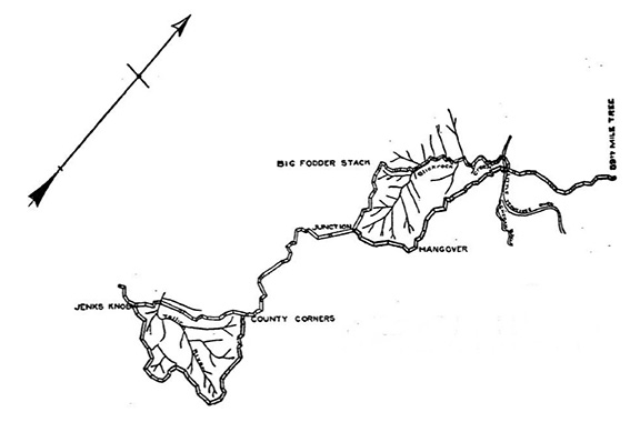
The rough rugged land between the two states was in the Slickrock Creek area, around the Hangover and Stratton Bald near Robbinsville and the headwaters of Tellico River.
For years the land was shared in common, more for what was grown on it than who owned the land. Hogs ran free with notched ears to identify the owners, everyone hunted the same ground, ginseng was dug and belonged to the founder. But that changed with the increasing demand for timber and the advancing means of removing the timber by railroad.
In 1900, Tennessee made a new claim that encompassed land claimed by North Carolina. Rather than accepting what is the state border today, those living in Cherokee County found Tennessee was claiming land that would encompass Graham County and much of the northern part of Cherokee County.
Landowner Jasper Fain owned 35,000 North Carolina acres there, amassed by his father who had a successful iron forge. Fain was living on that land in the Snowbird Mountains, when in April 1899 four armed men from Tennessee appeared with plans to enforce Tennessee’s claim to the land, led by Deputy U.S. Marshal Murphy Anderson and Monroe County, Tenn., Sheriff W.B. Barr.
Barr read a federal court order charging Fain with trespassing and ordered him off the land. Fain declared he owned the land, was in North Carolina and not required to obey Tennessee law, citing the land had been in his family since prior to the Civil War.
The argument escalated, and when Fain left the party to fetch water the Tennesseans took possession of the house, started throwing Fain’s possessions out, and sawed through two beams causing the roof to cave. Reportedly guns were drawn. Fain was arrested, but it was too late to return to Tennessee. The party decided to camp at the house that night and take Fain in the following morning.
Fain was one of five landowners who had been targeted by Vernon K. Stevenson, a wealthy timber speculator who had a new interest in the mountain timber. The Western North Carolina Railroad had been completed in 1891 and was a link to national markets from what was considered some of the finest timberland in America. Stevenson and other lumber companies – like the Smoky Mountain Land, Lumber & Improvement Company – eagerly bought land in the disputed areas, using connections and political influence to take advantage of overlapping land grants and the lack of official documentation. Stevenson filed suit against Fain, attempting to take the land, and his Tennessee allies pushed it.
During the discussion that day, Fain had sent for help from his brother, Allen, in Murphy. At 2 a.m., Allen arrived with 10 men, including Cherokee County deputies. At gunpoint, they in turn arrested the Tennesseans and charged them with criminal trespass, assault and false imprisonment, then took the prisoners to Murphy, where they were held in the Elliott Hotel.
It was time for the courts to be involved, with both states claiming jurisdiction, but neither state could produce the original documents from the 1821 survey. Jurisdiction meant the state with the rightful claim had political jurisdiction, authority to tax and enforce laws, and its citizens owned possession of the land’s assets.
A district judge decided for Fain and North Carolina, with authorities continuing to hold the Tennesseans. An Appellate Court disagreed, ordered the Tennessee men freed and Fain arrested. The case was headed for the U.S. Supreme Court if justices were willing to hear the case.
With no official documentation the case relied on the depositions of 62 elderly witnesses and what they recalled of the original survey and where the state line was. It was at best an undependable assessment. The testimonies filled more than 2,000 pages. But with potential fortunes to be made from the timber on the disputed lands, both sides remained opposed.
Things took a turn in 1911, when a copy of the original Tennessee survey map was discovered by an archivist in Nashville, and a year later the diary of one of the original surveyors was found in an old desk by the surveyor’s grandson.
With the new evidence the Supreme Court ruled in favor of North Carolina and Fain and settled the line. The disagreement had been in question for 22 years.
The case was named State of North Carolina vs. State of Tennessee, and the ruling basically ended the use of common land, determining that every inch of land was owned by some deeded holder and with it the exclusive rights to everything on that land, especially timber.
The timber companies were soon taking advantage of the new ruling, moving in with timber crews, specially geared mountain locomotives and narrow gauge railroads into the timber cutting grounds, hiring the local men as timber men, and in short order changing the entire way of life in the North Carolina mountains.
Bruce Voyles’ local history column runs every other week in the Cherokee Scout. Email him at RoadsLessTraveled@cherokeescout.com.