
- Last in a two-part series.
The National Weather Service has released its report about Hurricane Helene, which ravaged the Southeast in late September 2024 and left western North Carolina dealing with death and destruction, from which it is still recovering.
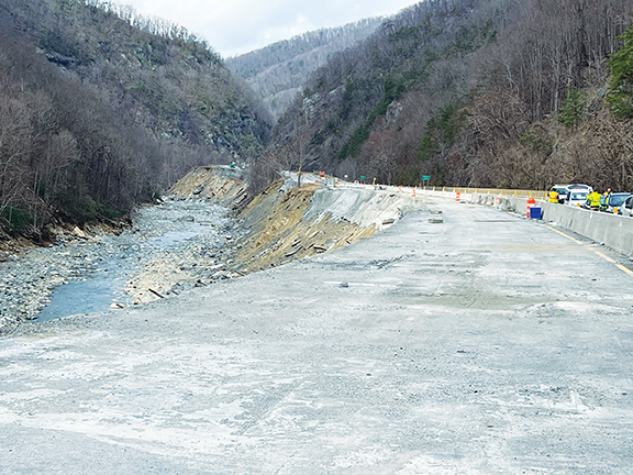
In part one of a two-part series last week, the Cherokee Scout shared a summary of what happened when Helene became the most devastating natural disaster in western North Carolina history. Helene passed through three states before reaching North Carolina before sunrise Sept. 27, suffering the worst destruction, most deaths, highest rainfall, fiercest wind gusts and record flooding from the storm, according to the report.
This week, the Scout shares how strong winds played a part in the storm, including tornadoes, before rain took over and flooded the region.
Winds
In North Carolina, while the strongest observed winds were measured at sites located within high topography of the southern Appalachians, strong winds also spread elsewhere across much of the western and central portions of the state. Sustained wind observations of 80.5 mph and 63.3 mph were recorded at Mount Mitchell and Frying Pan Mountain, respectively, around 8 a.m. Sept. 27, 2024.
These observations were at locations higher than 5,000 feet in elevation. Similar wind speeds likely affected many of the mountainous areas in western North Carolina.
Peak gusts measured at those stations were 106 mph and 87 mph, respectively. A wind gust to 101 mph was recorded near Banner Elk. Many mountain peaks in western North Carolina suffered extensive tree falls and damage due to these wind gusts.
Farther east, a wind gust of 65 mph was recorded at Charlotte Douglas International Airport. Sustained winds to tropical storm force with gusts to 60 mph were also observed in Southport near the coast.
Highest measured
wind gusts by state
Florida, Perry, Taylor County – 99 mph.
Florida, Dowling Park, Suwannee County – 99 mph.
Florida, Athena, Taylor County – 96 mph.
Georgia, Alma, Bacon County – 100 mph.
Georgia, Lake Park, Lowndes County – 95 mph.
Georgia, Douglas, Coffee County – 92 mph.
South Carolina, Laurens, Laurens County – 77 mph.
South Carolina, Beaufort, Beaufort County – 75 mph.
South Carolina, Anderson, Anderson County – 72 mph.
South Carolina, Aiken, Aiken County – 72 mph.
South Carolina, Sassafras Mountain, Pickens County – 72 mph.
North Carolina, Mount Mitchell, Yancey County – 106 mph.
North Carolina, Banner Elk, Watauga County – 101 mph.
North Carolina, Frying Pan Mountain, Haywood County – 87 mph.
Tornadoes
- In North Carolina, one EF-3 tornado occurred around 12:30 p.m. Sept. 27 in Nash County.
- After Helene became post-tropical, an EF-1 tornado occurred in Rockingham County and an EF-2 tornado occurred in Pittsylvania County, Va.
Highest rainfall totals by state (in descending order)
North Carolina, Busick, Yancey County – 30.78 inches.
South Carolina, Sunfish Mountain, Greenville County – 21.66 inches.
Georgia, Dillard, Rabun County – 14.64 inches.
Florida, Sumatra, Liberty County – 14.39 inches.
Tennessee, Embreeville, Washington County – 12.43 inches.
Virginia, Galax, Grayson County – 10.89 inches.
Ohio, Rosemount, Scioto County – 8.51 inches.
Alabama, Pansey, Houston County – 8.50 inches.
Kentucky, Henderson, Henderson County – 7.67 inches.
Illinois, Fort Massac St. Park, Massac County – 7.47 inches.
West Virginia, Bluefield, Mercer County – 6.11 inches.
Indiana, Henryville, Clark County – 5.69 inches.
Highest rainfall and record river crests
- Yancey County near Busick, 30.78 inches. South Toe River near Celo broke record by 8.7 feet – records back to 1957.
- Transylvania County, Connestee Falls, 29.98 inches. French Broad River at Blantyre broke record by 1.3 feet – records back to 1901.
- Mitchell County, 7 miles southwest of Spruce Pine, 23.31 inches. Cane Creek at Bakersville broke record by 2.2 feet – records back to 2009.
- Avery County, Banner Elk, 22.85 inches. No river totals.
- Henderson County, 5 miles southwest of Hendersonville, 21.70 inches. Mills River near Mills River broke record by 2.0 feet – records back to 1928). French Broad River near Fletcher broke record by 10.5 feet – records back to 2002. Bat Fork Creek broke record by 4.7 feet – records back to 2009.
- McDowell County,
4 miles northwest of Old Fort, 21.68 inches. Catawba River near Pleasant Gardens broke record by 4.3 feet – records back to 1981.
North Fork Catawba River above U.S. 221 broke record by 3.6 feet – records back to 2009.
- Watauga County, Foscoe, 21.60. No river totals.
- Buncombe County, 6 miles southeast of Black Mountain, 21.07 inches. Swannanoa River at Biltmore broke record by 6.6 feet – records back to 1901. French Broad River at Asheville broke record by 1.7 feet – records back to 1901; Ivy River near Barnardsville broke record by 8.7 feet – records back to 2009.
- Polk County, Saluda, 18.24 inches. No river totals.
- Alleghany County, 4 miles south-southwest of Sparta, 17.37 inches. No river totals.
- Ashe County, 9 miles south-southeast of West Jefferson, 17.08 inches. No river totals.
- Jackson County, 3 miles northeast of Cashiers, 15.97 inches. Tuckasegee River at Barker’s Creek broke record by 1.1 feet – records back to 2004.